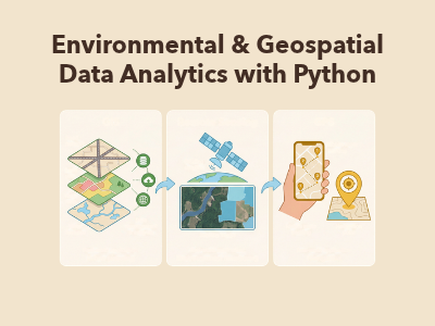
Environmental science and geospatial research increasingly require the ability to process large datasets, analyze environmental trends and interpret spatial information using computational tools. However, traditional undergraduate curricula often teach environmental science, spatial theory and programming separately, leaving graduates with limited experience in integrated, programmatic environmental data analysis. The Environmental & Geospatial Data Analytics with Python course bridges this gap by introducing participants to practical, industry-standard Python programming and geospatial data analytics workflows. Through hands-on exercises using Python, NumPy, Pandas, Matplotlib and GeoPandas, participants will learn to clean and analyze environmental time-series data, process raster and elevation grids, visualize environmental patterns and perform geospatial vector analysis. The course also guides participants in developing a real-world environmental capstone project using reproducible Google Colab and GitHub workflows.
Course Duration: 30 Hours || Total Weeks: 9 Weeks || Total Sessions: 20 Sessions || Course Mode: Hybrid
Class Size: 30 Participants
Course Fee:
Regular Fee: BDT 3,000
DIU Students: BDT 1,500 (50% waiver)
Prerequisites: No prior programming experience required.
1. Dr. Mahfuza Parveen,
Associate Professor & Head, Department of Environmental Science and Disaster Management (ESDM), DIU, PhD in Environmental Science/Ecological Engineering, 15+ years of environmental research and academic leadership experience.
2. Syed Nazmus Sakib,
Senior Lecturer, Department of Environmental Science and Disaster Management (ESDM), DIU, MSc in Disaster Management, Expertise in environmental GIS, spatial statistics, vector/raster models and coordinate reference systems.
3. Md. Abu Sayem Sarker
Founder & Instructor, Climate Scholars, Bangladesh, Expertise in Python programming, environmental data pipelines, remote sensing and Earth observation data science.
The course aims to:
Equip undergraduate students with practical Python-based data analysis and geospatial workflows.
Develop skills in using NumPy, Pandas, Matplotlib and GeoPandas.
Connect environmental time-series and raster grid data with core geospatial concepts, including Coordinate Reference Systems (CRS), vector geometries and spatial overlays.
Enable participants to process, analyze and visualize environmental datasets.
Mentor participants in developing a real-world environmental capstone decision-support project.
Module 1: Python Programming Foundations (Weeks 1–3)
Google Colab setup and GitHub integration.
Primitive data types and arithmetic operations.
Conditional statements and control flow.
Iterative loops and algorithmic problem-solving.
Modular functions and data structures.
Practical environmental examples, including Celsius conversions, discharge calculations and air-quality/flood-stage thresholds.
Module 2: Numerical Processing & 2D Raster Grids (Weeks 3–4)
Introduction to multidimensional NumPy arrays.
Vectorized arithmetic and benchmarking.
Raster grid slicing and processing.
Boolean masking and elevation thresholds.
Spatial surface temperature anomaly analysis.
Module 3: Tabular Data Wrangling, Time-Series & Visualization (Weeks 4–5)
Importing CSV and Excel environmental datasets.
Data cleaning and schema validation.
DateTime indexing and temporal data processing.
Missing-data interpolation.
Rolling seven-day averages.
Multi-station water-quality analysis.
Data visualization using Matplotlib, including dual-axis hydrographs.
Module 4: Geospatial Data Concepts & GeoPandas Vector Analysis (Weeks 6–7)
Vector and raster data models.
Coordinate Reference Systems (CRS).
WGS84 (EPSG:4326) and BTM (EPSG:3106).
Shapefile architecture.
GeoPandas GeoDataFrames.
Spatial geometry handling and coordinate reprojection.
Spatial joins and buffer generation.
Multi-layer thematic vector mapping.
Module 5: Capstone Formulation, Technical Mentorship & Defense (Weeks 8–9)
Identifying local environmental challenges.
Research scoping on river pollution, urban heat and air quality.
One-page project proposal preparation.
Data provenance review.
Individual technical mentorship and code clinic.
Reproducible Google Colab/GitHub repository development.
Two-page analytical memo preparation.
Oral technical project defense.
Participants will gain practical experience through:
Writing and executing Python scripts in Google Colab.
Processing environmental raster and elevation datasets using NumPy.
Cleaning and analyzing multi-station environmental time-series data using Pandas.
Creating analytical graphs and environmental visualizations using Matplotlib.
Performing spatial analysis, coordinate transformations and thematic mapping using GeoPandas.
Developing a capstone environmental decision-support project.
Final Project Deliverables:
One-page project proposal.
Reproducible Google Colab/GitHub repository.
Two-page analytical memo.
Oral technical project defense.
Assessment Requirements:
Minimum attendance: 80%.
Minimum assessment pass score: 50% (Assessments 1–3).
Participants who successfully complete the course requirements will receive a DIU Micro-Credential Certificate.



Join thousands of students already enrolled
Lifetime Support
Certificate included
